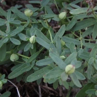
Hypericum perforatum (St John's Wort)
See: https://www.dpi.nsw.gov.au/__data/assets/pdf_file/0007/193075/St-Johns-wort.pdf
St. John's Wort (Hypericum perforatum) is a declared noxious weed in many local government areas of NSW. It is regarded as a significant environmental weed in Victoria and as an environmental weed in the ACT, South Australia, Western Australia and other parts of New South Wales. It is managed to some extent by government and community groups in Victoria, New South Wales and the ACT, and is listed as a priority environmental weed in six Natural Resource Management regions.
It is highly invasive and forms into dense colonies that crowd out native plants. It changes the soil structure to the point where many natives just die out, especially the more delicate ones such as orchids and some lilies and forbs. It is very hard to control since it is able to recover from underground rhizomes which produce new aerial growth each year. In the ACT its spread as been increasing over time and it is a problem in many nature reserves.
Hypericum perforatum is listed in the following regions:
Canberra & Southern Tablelands | Albury, Wodonga | South Coast | Hume | Gippsland
Species information
- Hypericum perforatum Scientific name
- St John's Wort Common name
- Not Sensitive
- Exotic
- Noxious or High Risk Weed or Pest
- Up to 1671.7m Recorded at altitude
- Machine learning
-
In flower
- External link More information
Follow Hypericum perforatum
Receive alerts of new sightings
SubscribeLocation information
-
Maps
9 Mile Hill TSR Ainslie volcanic grassland Albury Apex Park (The Pines) Aranda Bushland Attunga Point Banksia Street Wetland Corridor Bass Gardens Park, Griffith Bells TSR Bibbenluke Common Black Mountain Block 402 Blue Gum Point to Attunga Bay Bruce Ridge Bruce Ridge to Gossan Hill Bullen Range Bungonia National Park Callum Brae Campbell Park Woodland Charles Sturt University City Renewal Authority Area Cooleman Ridge Cooma North Ridge Reserve Crace Grasslands David Winterbottom Park Denman Prospect 2 Estate Deferred Area (Block 12) Dryandra St Woodland Eastern Hill Reserve Emu Creek Ewart Brothers Reserve Farrer Ridge Federation Hill Flea Bog Flat to Emu Creek Corridor Flea Bog Flat, Bruce Gibraltar Pines Gigerline Nature Reserve Googong Foreshore Gordon Pond Gossan Hill Griffith Woodland Gungahlin Pond Hoover Reserve Hughes Garran Woodland Hughes Grassy Woodland Hume Paddocks Isaacs Ridge Isaacs Ridge and Nearby Isabella Pond Jack Perry Reserve Jarramlee-West MacGregor Grasslands Jerrabomberra Wetlands Kama Kambah Pool Kosciuszko National Park Lake Burley Griffin West Legacy Park Woodland Reserve Lower Cotter Catchment Lower Molonglo Mawson Ponds Mcleods Creek Res (Gundaroo) McQuoids Hill Meringo Nature Reserve Micalong Gorge Molonglo River Reserve Mount Ainslie Mount Ainslie to Black Mountain Mount Majura Mount Mugga Mugga Mount Painter Mount Pleasant Mount Taylor Nail Can Hill Namadgi National Park National Arboretum Forests Nine Mile Reserve Norris Hill Oakey Hill Padman/Mates Park Percival Hill Pine Island to Point Hut Piney Ridge Pistol Club Bushland Point Hut Hill Point Hut to Tharwa Queanbeyan Nature Reserve Red Hill Nature Reserve Red Hill to Yarralumla Creek Red Light Hill Reserve Rob Roy Range Rocky Hill War Memorial Park and Bush Reserve, Goulburn Scrivener Hill Seven Creeks Wildlife Reserve Stirling Park Stranger Pond Tarengo Reserve (Boorowa) The Fair, Watson The Pinnacle Tidbinbilla Nature Reserve Tuggeranong Creek to Monash Grassland Tuggeranong Hill Tuggeranong Homestead A.C.T. Umbagong District Park University of Canberra Urambi Hills Urana Road Bushland Reserves Wanna Wanna Nature Reserve Wanniassa Hill Watson Green Space Watson Woodlands West Belconnen Pond Wodonga WREN Reserves -
Survey points
Bemboka River Reserve BLU111: Condor @ Pabral Rd Monitoring Site 064 - Remnant Point 11 Point 4997 Saint Marks Grassland - Barton ACT -
Places
Farrer, ACT Goulburn, NSW O'Malley, ACT Watson, ACT


