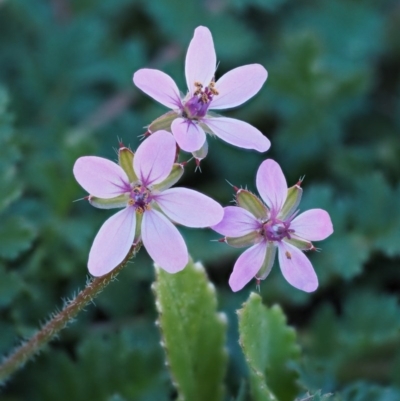
Erodium cicutarium (Common Storksbill, Common Crowfoot)
Environmental weed in Victoria.
http://keyserver.lucidcentral.org/weeds/data/media/Html/erodium_cicutarium.htm
Erodium cicutarium is listed in the following regions:
Canberra & Southern Tablelands | Albury, Wodonga | South Coast
1 2
Species information
- Erodium cicutarium Scientific name
- Common Storksbill, Common Crowfoot Common name
- Not Sensitive
- Exotic
- Minor weed or pest
- Up to 1172m Recorded at altitude
- Machine learning
-
In flower
- External link More information
Location information
-
Maps
Ainslie volcanic grassland Aranda Bushland Banksia Street Wetland Corridor Bass Gardens Park, Griffith Birrigai Black Flat at Corrowong Black Lake & Black Lake TSR (near Bibbenluke) Bruce Ridge Bullen Range Bungonia National Park City Renewal Authority Area Cooleman Ridge Cotter Reserve Crace Grasslands Cuumbeun Nature Reserve Dryandra St Woodland Dunlop Grasslands Fadden Hills Pond Ginninderry Conservation Corridor Googong Foreshore Goulburn Mulwaree Council Griffith Woodland Higgins Woodland Hughes Garran Woodland Hughes Grassy Woodland Illilanga & Baroona Isaacs Ridge Isaacs Ridge and Nearby Jerrabomberra Wetlands Lyneham Wetland Mcleods Creek Res (Gundaroo) McQuoids Hill Molonglo River Reserve Mount Ainslie Mount Ainslie to Black Mountain Mount Jerrabomberra Mount Jerrabomberra QP Mount Majura Mount Mugga Mugga Mount Painter Mount Pleasant Mulligans Flat Namadgi National Park National Arboretum Woodland Pine Island to Point Hut Point Hut to Tharwa Red Hill to Yarralumla Creek Rugosa Sullivans Creek, Lyneham South Sullivans Creek, Turner The Fair, Watson The Pinnacle Top Hut TSR Tuggeranong Hill Wanniassa Hill Watson Woodlands Woodstock Nature Reserve -
Places
Bungendore, NSW Capital Hill, ACT Dunlop, ACT Gundaroo, NSW Kenny, ACT Michelago, NSW Narrabundah, ACT O'Connor, ACT Russell, ACT Strathnairn, ACT Theodore, ACT Watson, ACT Whitlam, ACT


